Known for its mountains, forests, mesas, canyons, and more, Colorado’s landscape is one of the most diverse in the USA. All of that and more are in focus in this elevation map, which magnifies DEM data and exaggerates elevations to create a compelling visual experience. The museum-quality map is produced on a 12-color gicleé printer using premium inks for intricately detailed, fade-free visuals. They are also printed on archival paper in the USA and certified to last 100 years.
Sale!


Colorado Elevation Map
Original price was: €60.00.€48.00Current price is: €48.00.
Related products
-
Sale!
Sale!
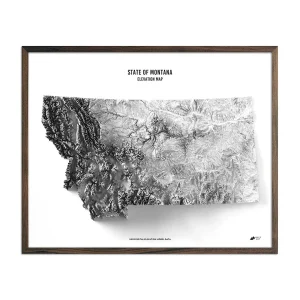

Montana Elevation Map
Original price was: €60.00.€48.00Current price is: €48.00. -
Sale!
Sale!


USA Elevation Map
Original price was: €60.00.€48.00Current price is: €48.00. -
Sale!
Sale!


Baja California Elevation Map
Original price was: €60.00.€48.00Current price is: €48.00. -
Sale!
Sale!


Wyoming Elevation Map
Original price was: €60.00.€48.00Current price is: €48.00.
Reviews
There are no reviews yet.