Boasting the longest coastline in the contiguous United States, Florida remains one of the country’s most popular destinations. This elevation map offers a unique perspective on the Sunshine State through the use of DEM data that magnified the features of its terrain by exaggerating their elevations and applying hillshade. The maps are produced on a 12-color gicleé printer using premium inks for intricately detailed, fade-free visuals. The maps are printed on archival paper in the USA and certified to last 100 years.
Sale!


Florida Elevation Map
Original price was: €60.00.€48.00Current price is: €48.00.
Related products
-
Sale!
Sale!


California Elevation Map
Original price was: €60.00.€48.00Current price is: €48.00. -
Sale!
Sale!
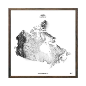

Canada Elevation Map
Original price was: €68.00.€54.40Current price is: €54.40. -
Sale!
Sale!


Washington D.C. Elevation Map
Original price was: €60.00.€48.00Current price is: €48.00. -
Sale!
Sale!


USA Elevation Map
Original price was: €60.00.€48.00Current price is: €48.00.
Reviews
There are no reviews yet.